Hwy. 19 bridge Tide Charts & Fishing
Friday, November 13 · NOAA station 8727012 (Hwy. 19 bridge, Pithlachascotee River)
Tides live · forecast as of 9:51 AM ET
Tide chart and current conditions
Tide now
0.0 ft
· Slack water
Next high
4:09 PM
2.2 ft · in 6h 18m
Next low
8:19 PM
1.5 ft · in 10h 28m
Wind
3 mph NE
Calm · gusts 10
Fishing score
58 /100
Good
drag to pan · scroll or pinch to zoom · hover for detail
| Day | Tide | Time | Height |
|---|---|---|---|
| Fri, Nov 13 | High | 1:08 AM | 3.5 ft |
| Fri, Nov 13 | Low | 9:48 AM | 0.0 ft |
| Fri, Nov 13 | High | 4:09 PM | 2.2 ft |
| Fri, Nov 13 | Low | 8:19 PM | 1.5 ft |
| Sat, Nov 14 | High | 1:47 AM | 3.4 ft |
| Sat, Nov 14 | Low | 10:34 AM | 0.2 ft |
| Sat, Nov 14 | High | 5:02 PM | 2.2 ft |
| Sat, Nov 14 | Low | 9:01 PM | 1.6 ft |
Today's Tide Times in Hwy. 19 bridge
Today in Hwy. 19 bridge, high tide arrives at 1:08 AM (3.5 ft) and again at 4:09 PM (2.2 ft), and low tide bottoms out at 9:48 AM (0.0 ft) and again at 8:19 PM (1.5 ft). That's a 3.5-foot swing — a solid mid-size swing with reliable current on each side of the extremes.
The sun rises at 6:51 AM and sets at 5:38 PM, under a waxing crescent (15% illuminated). Tidal range is in the middle of its two-week cycle.
Tomorrow starts with a high tide at 1:47 AM (3.4 ft) — see the 7-day outlook below to plan the week.
Fishing Score · Now
47/ 100
Best windows today
- 4:30 AM – 6:30 AMVery Good
- 7:30 AM – 9:30 AMGood
outgoing tide · dawn bite window · light wind
Sun & Moon
- Sunrise
- 6:51 AM
- Sunset
- 5:38 PM
Waxing Crescent
15% illuminated
Moderate tidal range this week.
Conditions
67°F
Clear
- Wind
- 3 mph NEgusts 10
- Waves
- 2.4 ft @ 5s
- Water temp
- 75°F
Calm — Glass — perfect for topwater
7-Day Fishing Outlook
Today
71° / 61°
Very Good
Best: 4:30 AM–6:30 AM
Sat, Nov 14
63° / 47°
Very Good
Best: 5:30 AM–7:30 AM
Sun, Nov 15
70° / 46°
Very Good
Best: 5:30 AM–7:30 AM
Mon, Nov 16
76° / 55°
Very Good
Best: 5:30 AM–7:30 AM
Tue, Nov 17
76° / 64°
Very Good
Best: 7:00 AM–9:00 AM
Wed, Nov 18
76° / 65°
Very Good
Best: 4:00 AM–6:00 AM
Thu, Nov 19
77° / 65°
Very Good
Best: 4:30 AM–6:30 AM
7-Day Tide Table for Hwy. 19 bridge
High and low tide times and heights for the next seven days, with sunrise (↑) and sunset (↓). Heights are relative to MLLW. NOAA predictions for station 8727012; local time.
| Day | Tides | Sun |
|---|---|---|
| TodayFri, Nov 13 |
| ↑ 6:51 AM↓ 5:38 PM |
| TomorrowSat, Nov 14 |
| ↑ 6:52 AM↓ 5:38 PM |
| Sun, Nov 15 |
| ↑ 6:53 AM↓ 5:37 PM |
| Mon, Nov 16 |
| ↑ 6:53 AM↓ 5:37 PM |
| Tue, Nov 17 |
| ↑ 6:54 AM↓ 5:36 PM |
| Wed, Nov 18 |
| ↑ 6:55 AM↓ 5:36 PM |
| Thu, Nov 19 |
| ↑ 6:56 AM↓ 5:36 PM |
What's Biting at Hwy. 19 bridge
Activity ratings reflect typical feeding seasons — not legal seasons. Regulations, closures, and size/bag limits change; always check current FWC regulations before keeping any fish.

Redfish
Sciaenops ocellatus
Season: Year-round, best in fall
Baits: Cut mullet, Live shrimp, Gold spoons
Sight-fish tailing reds on shallow flats on a flooding tide. Fall schools push bait against oyster bars and grass edges.

Spotted Seatrout
Cynoscion nebulosus
Season: Year-round, best in cooler months
Baits: Live shrimp under a popping cork, Soft plastics, Topwaters
Drift grass flats in 2–6 feet with a popping cork ahead of the drift. Gator trout hunt alone in skinny water at dawn.

Sheepshead
Archosargus probatocephalus
Season: Winter – early spring
Baits: Fiddler crabs, Shrimp, Barnacles
Fish tight to pilings and rocks — the bite is a subtle tick. Set the hook the instant you feel weight; they steal baits for a living.

Common Snook
Centropomus undecimalis
Season: March – October (check season closures)
Baits: Live pilchards, Swimbaits, Topwater plugs
Work dock lights, mangrove edges, and passes on moving water. Summer beach snook cruise the first trough at first light.

Tarpon
Megalops atlanticus
Season: April – August migration
Baits: Live crabs, Threadfin herring, Swimbaits
Stake out passes and beaches during the spring migration — hill tides in the Keys are legendary. Bow to the king when it jumps.
Gear for These Conditions
TheAnglerStore →Matched to the species feeding at Hwy. 19 bridge right now.

Surf Rods
Okuma Tundra Surf Spinning Rod — 7 ft, 2-Piece
Okuma build the Tundra as a surf series and say so themselves, they describe it as favoured by catfish anglers and cost-conscious surf anglers.
$25.95Shop at TheAnglerStore →

Soft Baits
Zoom Fluke 4" — Smokin' Shad, 10-Pack
Same darting soft-jerkbait profile in the standard body, in a translucent shad pattern that covers most clear-water situations.
$3.99Shop at TheAnglerStore →

Terminal Tackle
Eagle Claw Lazer Sharp Offset Circle Sea Hook — 4/0, 50-Pack
The circle hook does the work for you: no strike, just let the rod load and the hook finds the corner of the jaw on its own.
$15.97Shop at TheAnglerStore →
Tools
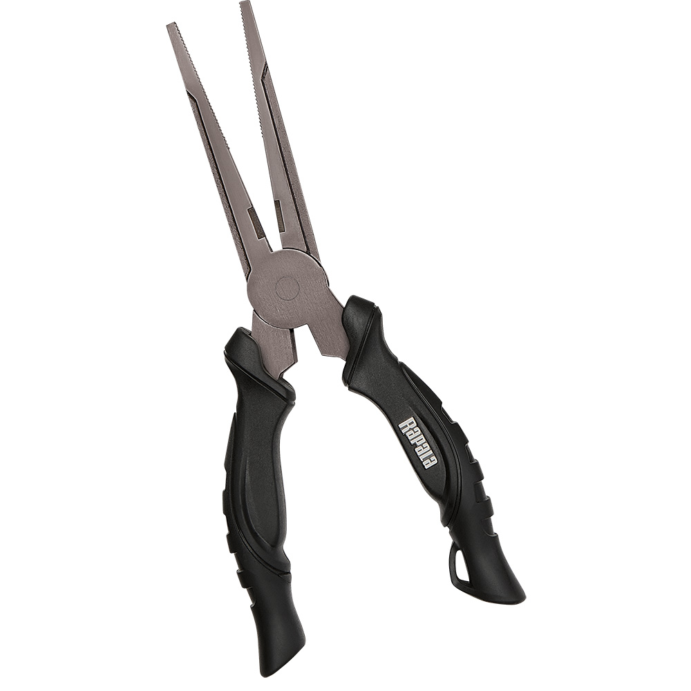
Rapala 8" Super Stainless Steel Pliers
Eight inches of stainless with an internal spring that holds the jaws open, so you can work one-handed while the other hand is busy holding a fish.
$32.99Shop at TheAnglerStore →
Hwy. 19 bridge Tide & Fishing FAQ
›What time is high tide in Hwy. 19 bridge today?
High tide in Hwy. 19 bridge today is at 1:08 AM (3.5 ft) and again at 4:09 PM (2.2 ft), measured at NOAA station 8727012 (Hwy. 19 bridge, Pithlachascotee River).
›What time is low tide in Hwy. 19 bridge today?
Low tide in Hwy. 19 bridge today is at 9:48 AM (0.0 ft) and again at 8:19 PM (1.5 ft).
›When is the best time to fish in Hwy. 19 bridge today?
Today's best fishing window at Hwy. 19 bridge is 4:30 AM–6:30 AM (rated Very Good, 74/100), driven by outgoing tide, dawn bite window, light wind. The score blends tide movement, dawn/dusk light, moon phase, wind, and water temperature.
›What fish are biting in Hwy. 19 bridge in November?
In November, the most active species at Hwy. 19 bridge are Redfish, Spotted Seatrout, Sheepshead. See the species section above for baits, techniques, and seasons.
›Is this the tide chart for Hudson?
Yes — Hwy. 19 bridge (NOAA station 8727012) is the closest official tide prediction station to Hudson, Florida, so these are the tide times anglers and boaters in Hudson plan around.
›How accurate is this Hwy. 19 bridge tide chart?
Predictions come directly from NOAA CO-OPS harmonic predictions for station 8727012 (Hwy. 19 bridge, Pithlachascotee River) and are the same data used in official tide tables. Actual water levels can vary with storms and barometric pressure, so treat predictions as planning guidance, not navigation data.
About Hwy. 19 bridge
NOAA maintains tide predictions for Hwy. 19 bridge as part of its Gulf Coast station network. This page tracks station 8727012 (Hwy. 19 bridge, Pithlachascotee River) live: today's highs and lows, the week ahead, sun and moon, and the conditions that decide whether it's worth wetting a line — all in one view. Hwy. 19 bridge is the closest NOAA tide station to Hudson, Florida — if you fish, paddle, or boat out of Hudson, these are the tide predictions to plan around.